Atlas 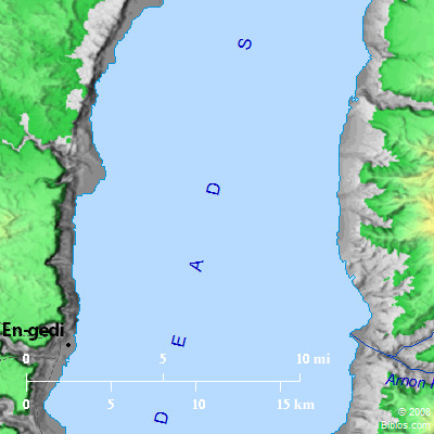 Sea of the Arabah (Salt Sea) and surrounding area
Maps Created using Biblemapper 3.0Additional data from OpenBible.info
You are free to use up to 50 Biblos coprighted maps (small or large) for your website or presentation. Please credit Biblos.com. Occurrences Deuteronomy 3:17 the Arabah also, and the Jordan and the border of it, from Chinnereth even to the sea of the Arabah, the Salt Sea, under the slopes of Pisgah eastward. Deuteronomy 4:49 and all the Arabah beyond the Jordan eastward, even to the sea of the Arabah, under the slopes of Pisgah. Joshua 3:16 that the waters which came down from above stood, and rose up in one heap, a great way off, at Adam, the city that is beside Zarethan; and those that went down toward the sea of the Arabah, even the Salt Sea, were wholly cut off. Then the people passed over right against Jericho. Joshua 12:3 and the Arabah to the sea of Chinneroth, eastward, and to the sea of the Arabah, even the Salt Sea, eastward, the way to Beth Jeshimoth; and on the south, under the slopes of Pisgah: 2 Kings 14:25 He restored the border of Israel from the entrance of Hamath to the sea of the Arabah, according to the word of Yahweh, the God of Israel, which he spoke by his servant Jonah the son of Amittai, the prophet, who was of Gath Hepher. Encyclopedia DEAD SEA, THEI. PRESENT AREA
II. FORMER ENLARGEMENT
III. LEVEL OF THE DEAD SEA IN EARLY HISTORIC TIMES
IV. CONSTITUTION OF THE WATER
V. CLIMATE
VI. ROADS
VII. MISCELLANEOUS ITEMS
1. The Plain of the Jordan
2. Ain Jidi (En-gedi)
3. The Fortress of Masada
4. Jebel Usdum (Mount of Sodom)
5. Vale of Siddim
6. El-Lisan
VIII. HISTORY
LITERATURE
The name given by Greek and Latin writers to the remarkable inland lake occupying the deepest part of the depression of the ARABAH (which see). In the Bible it is called the Salt Sea (Genesis 14:3 Deuteronomy 3:17); the Sea of the Plain (`Ardbhah). (Joshua 3:16); and the (East) Eastern Sea (Ezekiel 47:18 Joel 2:20). Among the Arabs it is still called Bahr Lut (Sea of Lot). By the time of Josephus it was called Lake Asphaltires (Ant., I, ix) from the quantities of bitumen or asphalt occasionally washed upon its shores and found in some of the tributary wadies.
I. Present Area.
The length of the lake from North to South is 47 miles; its greatest width is 10 miles narrowing down to less than 2 miles opposite Point Molyneux on el-Lisan. Its area is approximately 300 square miles. From various levelings its surface is found to be 1,292 ft. below that of the Mediterranean, while its greatest depth, near the eastern shore 10 miles South of the mouth of the Jordan is 1,278 ft. But the level varies from 10 to 15 ft. semiannually, and more at longer intervals; and we are not sure from which one of these levels the above figures have been derived. Throughout the northern half of the lake on the East side the descent to the extreme depth is very rapid; while from the western side the depth increases more gradually, especially at the extreme northern end, where the lake has been filled in by the delta of the Jordan.
About two-thirds of the distance to the southern end, the peninsula, el-Lisan ("the Tongue"), projects from the East more than half-way across the lake, being in the shape, however, of a boot rather than a tongue, with the toe to the North, forming a bay between it and the eastern mainland. The head of this bay has been largely filled in by the debris brought down by Wady Kerak, and Wady Ben Hamid, and shoals very gradually down to the greatest depths to the North. The toe of this peninsula is named Point Costigan, and the heel, Point Molyneux, after two travelers who lost their lives about the middle of the 19th century in pioneer attempts to explore the lake. Over the entire area South of Point Molyneux, the water is shallow, being nowhere more than 15 ft. deep, and for the most part not over 10 ft., and in some places less than 6 ft. In high water, the lake extends a mile or more beyond low-water mark, over the Mud Flat (Sebkah) at the south end.
From the history of the crossing of the Jordan by Joshua and the expedition of Chedorlaomer when Lot was captured, it is evident that the outlines of the sea were essentially the same 3,500 years ago as they are now, showing that there has been no radical change in climatic conditions since then.
II. Former Enlargement.
But if we go back a few thousand years into prehistoric times the evidence is abundant that the valley has witnessed remarkable climatic changes (see ARABAH). At Ain Abu Werideh, about 40 miles beyond the south end of the lake, Hull in 1883 discovered deposits of an abandoned shore line 1,400 ft. above its level (see ARABAH). A pronounced abandoned shore line at the 650 ft. level had been observed first by Tristram, and noted afterward by many travelers. But from the more detailed examination made by Professor Ellsworth Huntington in 1909 (see Palestine and Its Transformation) five abandoned shore lines of marked size have been determined, surrounding the valley at the following approximate heights above the present level of the lake: 1,430, 640, 430, 300 and 250 ft. He writes that "at its greatest extent the sea stretched at least 30 miles south of its present termination, while northward it probably covered the Sea of Galilee and the Waters of Merom, and sent an arm into the Vale of Jezreel.. Lacustrine deposits exist in the Jordan valley shortly south of the Sea of Galilee. A mile north of Jisr el-Mujamiyeh, as the modern railroad bridge is called, a tilted series of clays, apparently lacustrine, lies under some untilted whitish clays, also apparently lacustrine. The elevation here is about 840 ft. below that of the Mediterranean Sea, or 450 above the Dead Sea.. So far as can be detected by the aneroid the highest deposits (about the Dead Sea) lie at the same elevation on all sides of the lake."
There are also numerous minor strands below the 250 ft. major strand. These are estimated by Huntington as 210, 170, 145, 115, 90, 70, 56, 40, 30 and 12 ft. above the lake successively, It is noted, also, that the lower beaches all show less erosion than those above them. This certainly points to a gradual diminution of the water in the basin during the prehistoric period, while on the other hand there is much evidence that there has been a considerable rise in the water within the historic period. Date palms and tamarisks are seen standing out from the water in numerous places some little distance from the present shore where the water is several feet deep. These are of such size as to show that for many years the soil in which they grew was not subject to overflow. As long ago as 1876 Merrill noticed such trees standing in the water 40 ft. from the shore, near the Northeast corner of the lake (East, of the Jordan, 224). Numerous trunks of date palms and tamarisks can now be seen submerged to a similar extent along the western shore. In 1818 Irby and Mangles (Travels, 454) saw a company of Arabs ford the lake from Point Molyneux to the west side, and noted that the line of the ford was marked by branches of trees which had been stuck into the bottom. In 1838 Robinson found the water at such a stage that the ford was impracticable and so it has been reported by all travelers since that time. But Mr. A. Forder, having recently examined the evidence for the Palestine Exploration Fund, learns from the older Arabs that formerly there was a well-known causeway leading from el-Lisan opposite Wady Kerak to Wady Umm Baghek, across which sheep, goats and men could pass, while camels and mules could be driven across anywhere in the water. Moreover the Arab guide said that the channel "was so narrow that the people of his tribe used to sit on the edge of the Lisan and parley with Arabs from the west as to the return of cattle that had been stolen by one or other of the parties." (See PEFS (April, 1910), 112.)
III. Level of, in Early Historic Times.
Numerous general considerations indicate that in the early historic period the level of the water was so much lower than now that much of the bay South of Point Molyneux was dry land. In Joshua 15:2, 5 the south border of Judah is said to extend from "the bay (tongue, Lisan) that looketh southward"; while the "border of the north quarter was from the bay (tongue, Lisan) of the sea at the end of the Jordan; and the border went up to Beth-hoglah, and passed along by the north of Beth-arabah." If the limits of the north end of the Dead Sea were the same then as now the boundary must have turned down to the mouth of the Jordan by a sharp angle. But according to the description it runs almost exactly East and West from beyond Jerusalem to Beth-hoglah, and nothing is said about any change in direction, while elsewhere, any such abrupt change in direction as is here supposed is carefully noted. Furthermore, in detailing the boundary of Benjamin (Joshua 18:19) we are told that "the border passed along to the side of Beth-hoglah northward; and the goings out of the border were at the north bay (tongue, Lisan) of the Salt Sea, at the south end of the Jordan: this was the south border." This can hardly have any other meaning than that the north end of the Dead Sea was at Beth-hoglah. From these data Mr. Clermont-Ganneau (see Recueil d'archeologie orientale, V (1902), 267-80) inferred that in the time of Joshua the level of the sea was so much higher than now that a tongue-like extension reached the vicinity of Beth-hoglah, while the underlying topography was essentially the same as now. On the contrary, our present knowledge of the geologic forces in operation would indicate that at that time the Dead Sea was considerably lower than now, and that its rise to its present level has been partly caused by the silting up of a bay which formerly extended to Beth-hoglah.
The geological evidence concerning this point is so interesting, and of so much importance in its bearing upon our interpretation of various historical statements concerning the region, that it is worth while to present it somewhat in detail. As already stated (see ARABAH), the present level of the Dead Sea is determined by the equilibrium established between the evaporation (estimated at 20,000,000 cubic ft. per diem) over the area and the amount of water brought into the valley by the tributary streams. The present area of the sea is, in round numbers, 300 square miles. The historical evidence shows that this evaporating surface has not varied appreciably since the time of Abraham. But the encroachments of the delta of the Jordan upon this area, as well as of the deltas of several other streams, must have been very great since that period. The effect of this would be to limit the evaporating surface, which would cause the water to rise until it overflowed enough of the low land at the south end to restore the equilibrium.
It is easy to make an approximate calculation of the extent to which these encroachments have tended to narrow the limits of the original lake. The sediment deposited by the Jordan, at the north end of the Dead Sea, is practically all derived from the portion of the drainage basin between it and the Sea of Galilee-the latter serving as a catch-basin to retain the sediment brought down from the upper part of the valley. The Zor, or narrow channel which the Jordan has eroded in the sedimentary plain through which it flows (see JORDAN, VALLEY OF), is approximately half a mile wide, 100 feet deep, and 60 miles long. All the sediment which formerly filled this has been swept into the head of the sea, while the Jarmuk, the Jabbok, and a score of smaller tributaries descending rapidly from the bordering heights of Gilead, three or four thousand ft. above the valley, bring an abnormal amount of debris into the river, as do a large number of shorter tributaries which descend an equal amount from the mountains of Galilee, Samaria, and Judah. The entire area thus contributing to this part of the Jordan is not less than 3,000 square miles.
All writers are impressed by the evidence of the torrential floods which fill these water courses after severe storms. The descent being so rapid, permits the water after each rainfall to run off without delay, and so intensifies its eroding power. The well-known figure of our Lord (Matthew 7:26) in describing the destruction of the house which is built upon the sand, when the rains descend and the winds beat upon it, is drawn from Nature. The delta terraces at the mouths of such mountain streams where they debouch on the lowlands are formed and re-formed with extreme rapidity, each succeeding storm tending to wash the previous delta down to lower levels and carry away whatever was built upon it.
The storms which descend upon the plains of Gilead, as well as those upon the Judean hills, are exceedingly destructive. For though the rainfall at Jerusalem, according to the observations of Chaplin (see J. Glaisher, "On the Fall of Rain at Jerusalem," PEFS (January, 1894), 39) averages but 20 inches annually, ranging from 32, 21 inches in 1878 to 13, 19 inches in 1870, nearly all occurs in the three winter months, and therefore in quantities to be most effective in erosive capacity. And this is effective upon both sides of the Jordan valley, in which the rainfall is very slight. "Day after day," Tristram remarks, "we have seen the clouds, after pouring their fatness on Samaria and Judea, pass over the valley, and then descend in torrents on the hills of Gilead and Moab," a phenomenon naturally resulting from the rising column of heated air coming up from the torrid conditions of the depressed Jordan valley.
Tristram (The Land of Moab, 23, 24) gives a vivid description of the effect of a storm near Jerusalem. As his party was encamped during the night the whole slope upon which they pitched became a shallow stream, while "the deep ravines of the wilderness of Judah (were) covered with torrents, and tiny cascades rolling down from every rock.. So easily disintegrated is the soft limestone of these wadies, that the rain of a few hours. did more to deepen and widen the channels than the storms of several years could effect on a Northumbrian hillside. No geologist could watch the effect of this storm without being convinced that in calculating the progress of denudation, other factors than that of time must be taken into account, and that denudation may proceed most rapidly where rains are most uncertain." Lieutenant Lynch writes that while ascending the Kerak "there came a shout of thunder from the dense cloud which had gathered at the summit of the gorge, followed by a rain, compared to which the gentle showers of our more favored clime are as dew drops to the overflowing cistern.. The black and threatening cloud soon enveloped the mountain tops, the lightning playing across it in incessant flashes, while the loud thunder reverberated from side to side of the appalling chasm. Between the peals we soon heard a roaring and continuous sound. It was the torrent from the rain cloud, sweeping in a long line of foam down the steep declivity, bearing along huge fragments of rocks, which, striking against each other, sounded like mimic thunder."
I can bear similar testimony from observations when traveling in Turkestan where the annual rainfall is only about 4 inches. At one time a storm was seen raging upon the mountains 20 miles away, where it spent its entire force without shedding a drop upon the plain. Upon skirting the base of the mountain the next day, however, the railroad track was covered for a long distance 2 or 3 ft. deep with debris which had been washed down by the cloudburst. No one can have any proper comprehension of the erosive power of the showers of Palestine without duly taking into account the extent and the steepness of the descent from the highlands on either side, and the irregularity of the rainfall. These form what in the Rocky Mountains would be called arroyos. After the debris has been brought into the Jordan by these torrents, and the rise of water makes it "overflow all its banks," the sediment is then swept on to the Dead Sea with great rapidity.
All these considerations indicate that the deltas of the streams coming into the valley of the Jordan and the Dead Sea must be increasing at an unusually rapid rate. It will be profitable, therefore, to compare it with other deltas upon which direct observations have been made. The Mississippi River is sweeping into the Gulf of Mexico sediment at a rate which represents one foot of surface soil over the whole drainage basin, extending from the Rocky Mountains to the Alleghenies, in a little less than 5,000 years. The Hoang-Ho is lowering its drainage basin a foot in 1,464 years, while the river Po is reducing its level a foot in 729 years. So rapidly has the river Po filled up its valley that the city of Adria, which was a seaport 2,000 years ago, is now 14 miles from the mouth of the river. The Tigris and Euphrates rivers have silted up the head of the Persian Gulf nearly 100 miles. (See Croll, Climate and Time, 332, 333; Darwin, Formation of Vegetable Mould through the Action of Worms, 233.) From these considerations it is a conservative estimate that the tributaries of the Jordan valley between the Lake of Galilee and the Dead Sea bring down sediment enough to lower the basin one foot in 2,000 years, so that since the time of Abraham 167,270,400,000 cubic feet of solid matter have been added to its delta. This would cover 25 square miles 250 ft. deep. Taking into consideration the probable depth of water at the north end of the sea, it is, therefore, not an extravagant supposition that the Jordan delta has encroached upon the sea to the extent of 15 or 20 square miles, limiting the evaporating surface to that extent and causing the level of the water to rise, and extend an equal amount over the low lands at the south end.
At the same time the other streams coming directly into the lake have been contributing deltas to narrow its margin at various points. The Kerak, the Amen and the Zerka Ma'ain bring in an immense amount of sediment from the East; el-Hessi, el-Jeib and el-Fikri from the South; and Wady el. Muhauwdt, el-Areyeh and the Kedron, with numerous smaller intermediate streams, from the West. A detailed examination of these deposits will serve the double purpose of establishing the point in question and of giving a vivid conception of the sea and its surroundings.
Throughout the lower part of its course the river Jordan flows as has been already said, through a narrow gorge called the Zor, which the river has eroded in the soft sedimentary deposits which cover the bottom of the valley (or Ghor) from side to side. Opposite Jericho the Ghor is about 15 miles wide. The Zor, however, does not average more than one-half mile in width and is about 100 ft. lower than the general level of the Ghor, But at "the Jews' Castle." about 8 miles from the mouth of the Jordan, the Zor begins to enlarge and merge into a true delta. The embankment of the Zor slopes away in a Southwest direction till it reaches the Judean mountains at Khurbet Kumran. 10 miles distant, leaving a triangle of low land between it and the Dead Sea averaging fully one mile in width and being nearly 3 miles wide opposite the mouth of the Jordan. The face of the embankment separating the Zor from the Ghor has in several places been deeply cut into by the small wadies which come down from the western mountains, and the wash from these wadies as well as that from more temporary streams after every shower has-considerably raised the western border of the Zor throughout this distance. But it can safely be estimated that the original boundary of the Dead Sea has here been encroached upon to the extent of 10 or 15 square miles. Again, upon the eastern side of the Jordan the other limb of the delta, though smaller, is equally in evidence. Merrill (East of the Jordan, 223, 224), in describing his survey of the region, says he was compelled to walk for some hours along the shore and then north to reach his horses, which evidently had been coming over the harder and more elevated surface of the Ghor. "The plain." he says, "for many square miles north of the sea is like ashes in which we often. sank over shoe."
Returning to the Northwest corner of the lake we find the delta deposit which we left at Khurbet Kumran extending 2 miles farther south with an average width of one-half mile to Ras Feshkah, which rises abruptly from the water's edge, and renders it impossible for travelers to follow along the shore. But just beyond Ras Feshkah a delta half a mile or more in length and width is projected into the sea at the mouth of Wady en Nar, which comes down from Jerusalem and is known in its upper portions as Kedron. This is the wady which passes the convent of Mar Saba and is referred to in such a striking manner in Ezekiel 47. Like most of the other wadies coming into the Dead Sea, this courses the most of its way through inaccessible defiles and has built up a delta at its mouth covered with "fragments of rock or boulders swept along by the torrent in its periodical overflows" (De Saulcy, I, 137, 138).
From Ras Feshkah to Ras Mersid, a distance of 15 miles, the shore is bordered with a deposit of sand and gravel averaging a half a mile in width, while opposite Wady edition Derajeh and Wady Husasa (which descend from Bethlehem and the wilderness of Tekoah) the width is, fully one mile. At the mouth of one of the smaller gorges De Saulcy noted what geologists call a "cone of dejection" where "the gravel washed down from the heights was heaped up to the extent of nearly 250 yards" (I, 44).
Ras Mersid, again, obstructs the passage along the shore almost as effectually as did Ras Feshkah, but farther south there is no other obstruction. The plain of En-gedi, connected in such an interesting manner with the history of David and with numerous other events of national importance, is described by the Palestine Exploration Fund as "about half a mile broad and a mile in length." This consists of material brought down for the most part by Wady el-'Areijeh, which descends from the vicinity of Hebron with one branch passing through Tekoah. The principal path leading from the west side of the Dead Sea to the hills of Judea follows the direction of this wady.
Between En-gedi and Sebbeh (Masada), a distance of 10 miles, the limestone cliffs retreat till they are fully 2 miles from the shore. Across this space numerous wadies course their way bringing down an immense amount of debris and depositing it as deltas at the water's edge. These projecting deltas were noticed by Robinson as he looked southward from the height above En-gedi, but their significance was not understood.
"One feature of the sea," he says, "struck us immediately, which was unexpected to us, namely, the number of shoal-like points and peninsulas which run into its southern part, appearing at first sight like flat sand-banks or islands. Below us on the South were two such projecting banks on the western shore, composed probably of pebbles and gravel, extending out into the sea for a considerable distance. The larger and more important of these is on the South of the spot called Birket el-Khulil, a little bay or indentation in the western precipice, where the water, flowing into shallow basins when it is high, evaporates, and deposits salt. This spot is just South of the mouth of Wady el-Khubarah" (BR, I, 501). One of these deltas is described by De Saulcy as 500 yds. in breadth and another as indefinitely larger.
Six miles South of Masada, probably at the mouth of Wady Umm Baghek, Lynch notes a delta extending "half a mile out into the sea." Still farther South the combined delta of the Wady Zuweirah and Wady Muhauwat covers an area of 2 or 3 square miles, and is dotted with boulders and fragments of rock a foot or more in diameter, which have been washed over the area by the torrential floods. Beyond Jebel Usdum, Wady el-Fikreh, draining an area of 200 or 300 square miles, has deposited an immense amount of coarse sediment on the West side of the Sebkah (a mud flat which was formerly occupied, probably by a projection of the Dead Sea). Into the South end of the depression, extending from the Sebkah to the Ascent of Akrabbim, deltas of Wady el-Jeib, Wady el-Khanzireh and Wady Tufileh have in connection with Wady Fikreh encroached upon the valley to the extent of 12 or 15 square miles. Although these wadies drain an area of more than 3,000 sq. miles, and the granitic formations over which they pass have been so disintegrated by atmospheric influences that an excessive amount of coarse sediment is carried along by them (see Hull, Mount Seir, etc., 104-106). In ascending them, one encounters every indication of occasional destructive floods.
Following up the eastern shore, Wady el-Hessi coming down from the mountains of Edom has built up the plain of Safieh which pushes out into the neck of the Sebkah and covers an area of 3 or 4 square miles. Farther North, Wady Kerak and Wady Beni Hamid have with their deltas encroached to the extent of 2 or 3 square miles upon the head of the bay, projecting into the Lisan east of Point Costigan. Still farther North, Wady Mojib (the Arnon) and Wady Zerka Ma'ain (coming down from the hot springs of Callirrhoe) have built up less pronounced deltas because of the greater depth of the water on the East side, but even so they are by no means inconsiderable, in each case projecting a half-mile or more into the lake. Putting all these items together, there can be little doubt that the area of the Dead Sea has been encroached upon to the extent of 25 or 30 square miles since the time of Abraham and that this has resulted in a rise of the general level of the water sufficient to overflow a considerable portion of the lagoon at the South end, thus keeping the evaporating area constant. The only escape from this conclusion is the supposition that the rainfall of the region is less than it was at the dawn of history, and so the smaller evaporating area would be sufficient to maintain the former level. But of this we have no adequate evidence. On the contrary there is abundant evidence that the climatic conditions connected with the production of the Glacial Period had passed away long before the conquest of the Vale of Siddim by Amraphel and his confederates (Genesis 14). The consequences of this rise of water are various and significant. It lends credibility to the persistent tradition that the sites of Sodom and Gomorrah are covered by the shallow water at the South end of the sea, and also to the statement of Scripture that the region about these cities (on the supposition that they were at the South end of the sea) was like the garden of the Lord; for that plain was then much larger than it is now, and was well watered, and possessed greater elements of fertility than are now apparent. Furthermore, this supposed lower level of the lake in early times may have greatly facilitated the passage of armies and caravans from one end to the other, thus rendering it more easy to understand the historical statements relating to the earliest periods of occupation. Even now the road at the base of Jebel Usdum which is open at low water is impassable at high water. On the last of December, 1883, Professor Hull (Mount Seir, etc., 133) traversed the shore at the base of the salt cliffs along a gravel terrace 100 ft. wide, which "abruptly terminated in a descent of about 5 ft. to the line of driftwood which marked the upper limit of the waters." On the 1st of January, 1901, the water along the base of the salt cliffs was so deep that it was impossible for my party to pass along the shore. It is easy to believe that the level might have been lowered sufficiently to expose a margin of shore which could be traversed on the West side from one end to the other.
IV. Constitution of the Water.
As in the case of all enclosed basins, the waters of the Dead Sea are impregnated to an excessive degree with saline matter. "The salt which they contain," however, "is not wholly or even principally common salt, but is mostly the chloride and bromide of magnesium and calcium, so that they are not merely a strong brine, but rather resemble the mother liquors of a saltpan left after the common salt has crystallized out" (Dawson, Egypt and Syria, 123). The following analysis is given by Booth and Muckle of water brought by Commander Lynch and taken by him May 5 from 195 fathoms deep opposite the mouth of Wady Zerka Ma'ain. Other analyses vary from this more or less, owing doubtless to the different localities and depths from which the specimens had been obtained. Specific gravity at 60 degrees.... 1, 22742 Chloride of magnesium....... 145, 8971 Chloride of calcium......... 31.0746 Chloride of sodium......... 78, 5537 Chloride of potassium....... 6, 5860 Bromide of potassium....... 1, 3741 Sulphate of lime......... 0, 7012 ---- sub-total: 264, 1867 Water............. 735, 8133 ---- Total: 1000.0000 Total amount of solid matter found
by direct experiment....... 264.0000 What is here labeled bromide of potassium, however, is called by most other analysts bromide of magnesium, it being difficult to separate and distinguish these elements in composition. The large percentage of bromide, of which but a trace is found in the ocean, is supposed to have been derived from volcanic emanations. As compared with sea water, it is worthy of note that that of the Dead Sea yields 26 lbs. of salts to 100 lbs. of water, whereas that of the Atlantic yields only 6 lbs. in the same quantity. Lake Urumiah is as salty as the Dead Sea.
As results of this salinity the water is excessively buoyant and is destructive of all forms of animal life. Lynch found that his metal boats sank an inch deeper in the Jordan when equally heavily laden than they did in the Dead Sea. All travelers who bathe in it relate that when they throw themselves upon their backs their bodies will be half out of the water. Josephus (BJ, IV, viii, 4) relates that the emperor Vespasian caused certain men who could not swim to be thrown into the water with their hands tied behind them, and they floated on the surface. Dead fish and various shells are indeed often found upon the shore, but they have evidently been brought in by the tributary fresh-water streams, or belong to species which live in the brackish pools of the bordering lagoons, which are abundantly supplied with fresh water.
The report extensively circulated in earlier times that birds did not fly over the lake has no foundation in fact, since some species of birds are known even to light upon the surface and frolick upon the waters. The whole depression is subject to frequent storms of wind blowing through its length. These produce waves whose force is very destructive of boats encountering them because of the high specific gravity of the water; but for the same reason the waves rapidly subside after a storm, so that the general appearance of the lake is placid in the extreme.
The source from which these saline matters have been derived has been a subject of much speculation-some having supposed that it was derived from the dissolution of the salt cliffs in Jebel Usdum. But this theory is disproved by the fact that common salt forms but a small portion of the material held in solution by the water. It is more correct to regard this salt mountain as a deposit precipitated from the saturated brine which had accumulated, as we have supposed, during the Cretaceous age. Probably salt is now being deposited at the bottom of the lake from the present saturated solution to appear in some future age in the wreck of progressive geological changes. The salts of the Dead Sea, like those in all similarly enclosed basins, have been brought in by the streams of water from all over the drainage basin. Such streams always contain more or less solid matter in solution, which becomes concentrated through the evaporation which takes. place over enclosed basins. The ocean is the great reservoir of such deposits, but is too large to be affected to the extent noticeable in smaller basins. The extreme salinity of the Dead Sea water shows both the long continuance of the isolation of the basin and the abundance of soluble matter contained in the rocks of the inscribed area. The great extent of recent volcanic rocks, especially in the region East of the Jordan, accounts for the large relative proportion of some of the ingredients.
V. Climate.
Because of the great depression below sea level, the climate is excessively warm, so that palms and other tropical trees flourish on the borders of the rivers wherever fresh water finds soil on which to spread itself. Read Complete Article... |