Atlas 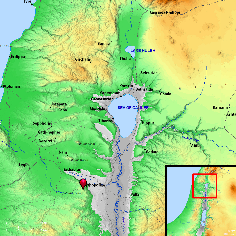 Mount Gilboa and surrounding region Maps Created using Biblemapper 3.0 Additional data from OpenBible.info You are free to use up to 50 Biblos coprighted maps (small or large) for your website or presentation. Please credit Biblos.com. Occurrences 1 Samuel 31:1 Now the Philistines fought against Israel: and the men of Israel fled from before the Philistines, and fell down slain on Mount Gilboa.1 Samuel 31:8 It happened on the next day, when the Philistines came to strip the slain, that they found Saul and his three sons fallen on Mount Gilboa. 2 Samuel 1:6 The young man who told him said, "As I happened by chance on Mount Gilboa, behold, Saul was leaning on his spear; and behold, the chariots and the horsemen followed hard after him. 1 Chronicles 10:1 Now the Philistines fought against Israel: and the men of Israel fled from before the Philistines, and fell down slain on Mount Gilboa. 1 Chronicles 10:8 It happened on the next day, when the Philistines came to strip the slain, that they found Saul and his sons fallen on Mount Gilboa. Encyclopedia GILBOA, MOUNTgil-bo'-a ([har hagilboa], "Mount of the Gilboa"): Unless we should read "Gilboa" for "Gilead" in Judges 7:3 (see GILEAD, 2) this mountain is mentioned in Scripture only in connection with the last conflict of Saul with the Philistines, and his disastrous defeat (1 Samuel 28:4; 1 Samuel 31:1, 8 2 Samuel 1:6, 21; 2 Samuel 21:12 1 Chronicles 10:1, 8). If Zer`in be identical with Jezreel-a point upon which Professor R.A.S. Macalister has recently cast some doubt-Saul must have occupied the slopes on the Northwest side of the mountain, near "the fountain which is in Jezreel" (1 Samuel 29:1). The Philistines attacked from the plain, and the battle went sore against the men of Israel, who broke and fled; and in the flight Jonathan, Abinadab and Malchi-shua, sons of Saul, were slain. Rather than be taken by his lifelong foes, Saul fell upon his sword and died (1 Samuel 31:1). |
    |